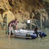
In all honesty for a small rib even doing relatively long trips circa 100 miles a basic gps and a vague idea of where you are going is usually enough, while nav theory is great and interesting your unlikely to be out of sight of land, unless visibility drops then charts are a great help If you know how to use them and know your location etc, you will likely have a small draught so water depth is an issue but not a huge one unless you are in an estuary and then they change so much the charts aren’t so useful, tide state and knowing local tide limits plays a much more important role, I regularly cross The Bristol Channel (25miles off open water) from South Wales to Somerset and Devon, ilfracombe and Watchet are favoured harbours to call into travel the welsh coastline from cardiff to worms head. Take trips up rivers and into bays on A sub 4m vessel. I carry gps and look at electronic charts when planning a trip but most important is some local knowledge and travelling with others occasional mechanical breakdowns happen
Have mooch around on this as it’s a great resource and shows you the sort of info a chart holds
i-Boating : Free Marine Navigation Charts & Fishing Maps