|
|
 16 August 2021, 23:11
|
#1
|
|
Member
Country: UK - England
Town: Appley Bridge
Boat name: RedNeck
Make: Excel SD360
Length: 3m +
Engine: Mercury EFI 20HP
MMSI: 235924407
Join Date: Jul 2020
Posts: 2,866
|
Not for "fishing"
After the weekend "SIB Outing in Scotland" it became very apparent that the one essential bit of kit that needs to be purchased is a plotter/sounder.
Reefs around Arron and line of sight navigation from Bute to Largs wasn't the easiest of things to do even in a group, and I would have found the going very slow/difficult if I was on my own.
The problem I have is every bit of research I'm doing goes down the same route "fish finder".
Now I'm not saying that I won't ever put a line in the water, I have and I will, but it's not my primary concern. Where I'm going and getting there safely, without hitting rocks/reefs, is what I'm looking for.
So suggestions, without bankrupting the bank and without being too technical (I still use an OS map and compass when I'm out on the hills) would be gratefully received.
__________________
|

|

|
|
16 August 2021, 23:46
|
#2
|
|
Member
Country: UK - England
Town: Cambridgeshire
Boat name: Nimrod II
Make: Aerotec 380
Length: 3m +
Engine: Yam 15 Tohatsu 9.8
Join Date: Nov 2007
Posts: 8,297
|
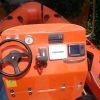
Keeping au fait with the manual nav methods is good (essential really) for backup but a small plotter on a SIB is life changing. I started with a small handheld Garmin Etrex with mapping about ten years ago then upgraded to a Garmin 45DV with full mapping seat mounted with a 7ah battery. Brilliant bit of kit.
The 45DV had a sounder transducer as well which was always fitted but with a SIB that draws less than an 40cm depth not quite so crucial.
Now to simplify and weight save have a larger handheld Garmin Montana with full mapping. It's not as clear on the screen or as responsive as the 45DV but still a damn good bit of kit given its portability.
I always carry the Etrex in my buoyancy aid pocket as a backup/emergency unit.
Both the DV45 and the Montana have full UK mapping installed. The Etrex doesn't have that full area capacity so you have the maps on the PC and download the area you'll be in... but it will take as much area as say one of The Gurnard's longer trips all at one time.
Some pics and comparisons.
__________________
|

|
|
|
16 August 2021, 23:52
|
#3
|
|
Member
Country: Australia
Town: Dalmeny
Make: zodiac
Length: 5m +
Engine: outboard
Join Date: May 2015
Posts: 1,200
|
Why not get the free trial navionics app and see how you go, if you then like it and how it performs on your phone or iPad etc then pay the yearly subscription.
__________________
|
|
|
|
|
17 August 2021, 12:57
|
#4
|
|
Member
Country: UK - England
Town: South Yorks
Boat name: Black Pig
Make: Ribcraft
Length: 5m +
Engine: DF140a
MMSI: 235111389
Join Date: Feb 2008
Posts: 11,883
|
Quote:
Originally Posted by Steve509926

After the weekend "SIB Outing in Scotland" it became very apparent that the one essential bit of kit that needs to be purchased is a plotter/sounder.
Reefs around Arron and line of sight navigation from Bute to Largs wasn't the easiest of things to do even in a group, and I would have found the going very slow/difficult if I was on my own.
The problem I have is every bit of research I'm doing goes down the same route "fish finder".
Now I'm not saying that I won't ever put a line in the water, I have and I will, but it's not my primary concern. Where I'm going and getting there safely, without hitting rocks/reefs, is what I'm looking for.
So suggestions, without bankrupting the bank and without being too technical (I still use an OS map and compass when I'm out on the hills) would be gratefully received.
|
I have a 5 Lowrance Hook sounder/plotter on the SIB, does the job & cost around £300. At that price point there are plenty to choose from & there are always offers on at the usual outlets. Stick with Lowrance(or any Navico clone) /Garmin/Raymarine & you wont go wrong. They all take Navionics charts which are the best option imho. The chart could well cost you more than the plotter, so keep an eye out for a bundle deal. Ideally, youre looking for Navionics Platinum, or gold as a minimum.
__________________
Rule#2: Never argue with an idiot. He'll drag you down to his level & then beat you with experience.
Rule#3: Tha' can't educate pork.
Rule#4: Don't feed the troll
|
|
|
|
|
17 August 2021, 13:15
|
#5
|
|
Member
Country: UK - England
Town: Dorset
Boat name: Seabadger 2
Make: Delta / Ribcraft 6.8
Length: 7m +
Engine: Various
MMSI: -
Join Date: May 2010
Posts: 742
|
Some guys I know are using "tough" I pad type devices loaded with Navionics App which is great tool for navigation. Sometimes if I'm out on the Kayak or small tenders etc with no nav gear I use the Navionics App on my smart phone to check navigation / tides / currents / depths and plot routes. It works well, better on some bigger screen such as I pad though I guess. Beware a "fishfinder" or echo sounder will give you readings of depths where ever you mount the transducer - normally at the back of the boat. This will only give you instantaneous readings of water depths as you go over the seabed, no indication of what's ahead of you. A combination unit - chartplotter / fishfinder combined can display navigation charts and or a combination of sounder and chart info
__________________
|
|
|
|
|
17 August 2021, 13:18
|
#6
|
|
RIBnet Supporter
Country: Ireland
Length: 4m +
Join Date: Feb 2008
Posts: 14,682
|
Quote:
Originally Posted by Pikey Dave
The chart could well cost you more than the plotter, so keep an eye out for a bundle deal. Ideally, youre looking for Navionics Platinum, or gold as a minimum.
|
There are often deals on used non-upgradeable charts - I have no idea how legit these are but I got one on Ebay recently as a backup for my other plotter (see what I did there?) - full UK & Ireland Gold for a very reasonable sum. Obviously, the navigation data may be a bit out of date, but unlikely to be an issue for a SIB?
__________________
I'm sorry, but there IS no Mars Bar.
|
|
|
|
|
17 August 2021, 14:36
|
#7
|
|
Member
Country: UK - England
Town: Appley Bridge
Boat name: RedNeck
Make: Excel SD360
Length: 3m +
Engine: Mercury EFI 20HP
MMSI: 235924407
Join Date: Jul 2020
Posts: 2,866
|
A few more questions and I think I will be on the path to enlightenment 
Does a chart plotter loaded with Navionics show water depth in real time or does it adjust for pre determined tide times or are the depths indicated taken at mean tide?
If it shows water depth in real time, is that done through GPS or does it mean a transducer is required? or can I get away without using a transducer?
If I just bought a chart plotter can a transducer be added at a latter date if I felt the need for one?
__________________
|
|
|
|
|
17 August 2021, 15:14
|
#8
|
|
Member
Country: UK - England
Town: Nottinghamshire
Make: Ranieri 15
Length: 4m +
Engine: Suzuki DF50
Join Date: Jul 2016
Posts: 1,279
|
Quote:
Originally Posted by Steve509926
If I just bought a chart plotter can a transducer be added at a latter date if I felt the need for one?
|
Only if you buy a combi device but then it will probably come with a transducer. Having separate units can be an advantage, now I've got a single Garmin Echomap I've less total screen area than my former Echo and GPSmap units and I have to use it in split screen mode.
The transducer measures water temperature and depth in real time. There's a selectable screen showing the state of tide for your location. Never needed Navionics so can't help much. Sand and mud shifts all the time, Navionics can't help with the unexpected, just gives a general depth like a paper chart. Charts always show the minimum (spring tide) depth, you add feet according to the current tide and time.
__________________
|
|
|
|
|
17 August 2021, 15:25
|
#9
|
|
Member
Country: UK - England
Town: Retford
Boat name: Spy-sea-one
Make: Excel 435
Length: 4m +
Engine: Suzuki Outboard/25/4
Join Date: Oct 2011
Posts: 7,454
|
My two pence worth for me doing the trips I do the bigger screen is best I have the lowrance hook 7 chart plotter sounder combo. It has split screens if you wish but I have just the chart showing with depth on huge scale overlay and 2 meter minimum depth alarm I do a lot of close in crusing and it works for me. I have a garmin hand held as backup but hard to read when is rough and raining. OMO
__________________
|
|
|
|
|
17 August 2021, 15:41
|
#10
|
|
Member
Country: UK - England
Town: Cambridgeshire
Boat name: Nimrod II
Make: Aerotec 380
Length: 3m +
Engine: Yam 15 Tohatsu 9.8
Join Date: Nov 2007
Posts: 8,297
|
Often a plotter comes without transducer allowing you to choose your own from that maker's model range. For you just wanting the plotter function this helps as... for now... you're not buying something you don't want. Of course there are sometimes bundle offers inc a transducer.
Are you asking if the depth measurement you see on the screen chart changes due to actual measured depth via transducer. If so not that I've ever known on any of the smaller plotters. I have no experience of the high end units though.
As an example this was the unit I had. Under £300 with no transducer but full UK charts included. Transducers from £60-£240 depending on the spec you want.
https://www.cactusnav.com/garmin-ech...r-p-22562.html
The UK charts alone were worth the price of the unit.
__________________
|
|
|
|
|
17 August 2021, 15:46
|
#11
|
|
Member
Country: UK - England
Town: Nottinghamshire
Make: Ranieri 15
Length: 4m +
Engine: Suzuki DF50
Join Date: Jul 2016
Posts: 1,279
|
Quote:
Originally Posted by Fenlander
Often a plotter comes without transducer allowing you to choose your own from that maker's model range.
|
Surely that makes it a combi (plotter/sonar) unit minus transducer then?
__________________
|
|
|
|
|
17 August 2021, 15:48
|
#12
|
|
Member
Country: UK - England
Town: Gloucester
Boat name: Lunasea
Make: Ribcraft
Length: 5m +
Engine: Suzi 140
MMSI: 232005050
Join Date: Sep 2007
Posts: 1,978
|
A plotter will show you the charted depth of water and obstructions e.g rocks ahead of and around you according to the chart datum used (min depth)
so worst case. I don't know of any that interactively adjust for actual tidal depth.
Any transducer - fixed or mobile will only tell you what's directly underneath at that point.
If going into shallow / rocky areas the only thing that will spot a submerged obstruction ahead is the Mark 1 eye -ideally fitted to a suitably placed crew member - e.g. hanging over the bow!
__________________
Member of the Macmillan Round the Isle of Wight Club
|
|
|
|
|
17 August 2021, 15:56
|
#13
|
|
Member
Country: UK - England
Town: Cambridgeshire
Boat name: Nimrod II
Make: Aerotec 380
Length: 3m +
Engine: Yam 15 Tohatsu 9.8
Join Date: Nov 2007
Posts: 8,297
|
>>>Surely that makes it a combi (plotter/sonar) unit minus transducer then?
Yep. I mention that Garmin unit because I found it faultless in operation/usability and as far as I know it is the only £300 unit that includes the whole UK charts.
Many/most/all others seem to need charts added and for example Navionics charts for the UK are about £245 for the standard set and £365 for the platinum type.
__________________
|
|
|
|
|
17 August 2021, 16:16
|
#14
|
|
Member
Country: UK - England
Town: Waterlooville
Boat name: Tickler
Make: Halmatic P22
Length: 6m +
Engine: Inboard Diesel 240HP
MMSI: 235115642
Join Date: Sep 2015
Posts: 1,777
|
Quote:
Originally Posted by Steve509926
A few more questions and I think I will be on the path to enlightenment
Does a chart plotter loaded with Navionics show water depth in real time or does it adjust for pre determined tide times or are the depths indicated taken at mean tide?
If it shows water depth in real time, is that done through GPS or does it mean a transducer is required? or can I get away without using a transducer?
If I just bought a chart plotter can a transducer be added at a latter date if I felt the need for one? |
As others have said, the plotter will show the charted depth. My Garmin and I'm sure lots of others have a tide function that will show you the tide height, current speed and direction at various locations so I guess it wouldn't be too big a step for them to provide the theoretical depth of water based on interpolating between tide height points in the surrounding area. I've not really looked and I'm pretty sure my Garmin can't do this.
I tend to remember or write down the tide times and heights and then use the twelfths rule to work out the depth over the charted depth. If I'm really keen I look at the tidal curve before I go out. The actual tide height is affected by wind direction and pressure so unless I'm somewhere with a really odd rise and fall, I tend to find the twelfths rule is good enough.
You can add a transducer later so long as you (obviously) buy a transducer compatible chart plotter. I use the depth info from the transducer in the Solent because you can't see the bottom and it's generally shallow. I also use the transducer to identify when I'm going to let the anchor go but it is a bit of a luxury and I think you'd be fine without one. Whats directly under the transducer is less important than what is in front of it and it doesn't give you that info.
The Southampton Boat Show is in mid September and has the potential for some bargains.
__________________
|
|
|
|
|
17 August 2021, 20:15
|
#15
|
|
Member
Country: UK - England
Town: Appley Bridge
Boat name: RedNeck
Make: Excel SD360
Length: 3m +
Engine: Mercury EFI 20HP
MMSI: 235924407
Join Date: Jul 2020
Posts: 2,866
|
Quote:
Originally Posted by Fenlander
Often a plotter comes without transducer allowing you to choose your own from that maker's model range. For you just wanting the plotter function this helps as... for now... you're not buying something you don't want. Of course there are sometimes bundle offers inc a transducer.
Are you asking if the depth measurement you see on the screen chart changes due to actual measured depth via transducer. If so not that I've ever known on any of the smaller plotters. I have no experience of the high end units though.
As an example this was the unit I had. Under £300 with no transducer but full UK charts included. Transducers from £60-£240 depending on the spec you want.
https://www.cactusnav.com/garmin-ech...r-p-22562.html
The UK charts alone were worth the price of the unit. |
Hi David, unfortunately I cant get the page to show.
The UK charts included, are they C-Map?
__________________
|
|
|
|
|
17 August 2021, 20:27
|
#16
|
|
Member
Country: UK - England
Town: Appley Bridge
Boat name: RedNeck
Make: Excel SD360
Length: 3m +
Engine: Mercury EFI 20HP
MMSI: 235924407
Join Date: Jul 2020
Posts: 2,866
|
Got the Cactus page working and now see that the charts are "UK & Ireland Blue Charts"
I cant find any info/reviews online.
Has anyone any experience of using these charts?
__________________
|
|
|
|
|
17 August 2021, 21:40
|
#17
|
|
Member
Country: UK - England
Town: Cambridgeshire
Boat name: Nimrod II
Make: Aerotec 380
Length: 3m +
Engine: Yam 15 Tohatsu 9.8
Join Date: Nov 2007
Posts: 8,297
|
They are Garmin's own. Folks with RIBs and other larger craft have their own preferences between mapping systems but for me the Garmin Bluechart is more than enough for a leisure use SIB.
And re anyone experience using them... well yes me... for ten years now.
__________________
|
|
|
|
|
17 August 2021, 21:44
|
#18
|
|
Member
Country: UK - England
Town: Appley Bridge
Boat name: RedNeck
Make: Excel SD360
Length: 3m +
Engine: Mercury EFI 20HP
MMSI: 235924407
Join Date: Jul 2020
Posts: 2,866
|
Quote:
Originally Posted by Fenlander
They are Garmin's own. Folks with RIBs and other larger craft have their own preferences between mapping systems but for me the Garmin Bluechart is more than enough for a leisure use SIB.
And re anyone experience using them... well yes me... for ten years now.
|
Thanks David.
I take it the shots of your Garmins #2 show Bluechart screens?
__________________
|
|
|
|
|
17 August 2021, 22:39
|
#19
|
|
Member
Country: UK - England
Town: Cambridgeshire
Boat name: Nimrod II
Make: Aerotec 380
Length: 3m +
Engine: Yam 15 Tohatsu 9.8
Join Date: Nov 2007
Posts: 8,297
|
Yes... they have slight differences as they display slightly differently on each device and they are different year versions.
__________________
|
|
|
|
|
17 August 2021, 22:41
|
#20
|
|
Member
Country: Australia
Town: Dalmeny
Make: zodiac
Length: 5m +
Engine: outboard
Join Date: May 2015
Posts: 1,200
|
Images from my Garmin g3 vision charts which I use on a Garmin 8410 and also for free on my phone. Its not actually free as you need to buy it for your Garmin plotter but once you do that you can have the charts on your phone and use it as you would in a boat. One image from my phone and the other from my plotter. As you can see, charts have come a long way since those basic contour line ones from the past (still available).
This same detail is also available with Navionics.
__________________
|
|
|
|
|
|
 Posting Rules
|
You may not post new threads
You may not post replies
You may not post attachments
You may not edit your posts
HTML code is Off
|
|
|
|
 Recent Discussions
 |
|
|
|
|
|
|
|
|
|
|
|
|
|
|
|
|
|
|
|
|
|
|
|
|
|
|
|
|
|
|
|
|
|


 BLACK PIG
 Piglet
 spy-sea-one
 Tickler