|
 27 April 2015, 08:28
|
#1
|
|
Member
Country: UK - England
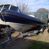
Boat name: Hysucat
Make: Hysucat
Length: 8m +
Engine: Twin Suzuki 175's
MMSI: 235102645
Join Date: Jun 2013
Posts: 861
|
Route planning help
Can anyone recommend something I can use on the web to help plan a cruise.
My Garmin is on the boat, and the boat is in Corsica - so I cant use that until I get there. In the meantime Id like to measure distances so I can plan my stops and choose harbours with fuel for the cruise I'm thinking about.
I cant seem to measure distances on Google maps unless I go by road !
__________________
|

|

|
|
27 April 2015, 08:46
|
#2
|
|
Member
Country: UK - England
Town: Thame
Boat name: Free-Flow
Make: Shearwater 6.8
Length: 6m +
Engine: Suzuki 175
Join Date: Mar 2012
Posts: 318
|
Try the Navionics webapp Navionics Webapp
There is a 'dividers' symbol bottom right which brings up two moveable pins , and gives the distance between them.
__________________
|
|
|
|
|
27 April 2015, 09:12
|
#4
|
|
Member
Country: UK - England
Boat name: Hysucat
Make: Hysucat
Length: 8m +
Engine: Twin Suzuki 175's
MMSI: 235102645
Join Date: Jun 2013
Posts: 861
|
Well, that's buggered up any chance of doing any work now 
I'm going to spend all day planning routes, checking harbours / fuel and then booking hotels. Goggling marinas, beaches and general daydreaming.
__________________
|
|
|
|
|
27 April 2015, 09:27
|
#5
|
|
Member
Country: UK - England
Boat name: Hysucat
Make: Hysucat
Length: 8m +
Engine: Twin Suzuki 175's
MMSI: 235102645
Join Date: Jun 2013
Posts: 861
|
Buckribster - on that Navoinics tool I cant seem to do any more than stick two pins in the chart and get a distance between them.
I suppose I could keep doing that leg by leg and add them up manually, but am I missing something ? Can I plot my whole route made up of many legs on screen ?
Cheers
__________________
|
|
|
|
|
27 April 2015, 09:56
|
#6
|
|
RIBnet admin team
Country: UK - Scotland
Boat name: imposter
Make: FunYak
Length: 3m +
Engine: Tohatsu 30HP
MMSI: 235089819
Join Date: Sep 2005
Posts: 11,622
|
You can get measurements on bing maps IIRC. Surprised if you can't on Google too.
On bing you can string together a wholecroute and edit points etc and it will give total distance. It's not perfect but for free not too shoddy either.
Personally I think for planning there is a lot to be said for a table full of paper cartography rather than eve a 15" laptop screen...
__________________
|
|
|
|
|
27 April 2015, 10:23
|
#7
|
|
Member
Country: UK - England
Town: Chesterfield
Boat name: Sea Quell
Make: Picton Cobra
Length: 5m +
Engine: Mercury 150 4 Stroke
MMSI: 235038298
Join Date: Sep 2003
Posts: 1,095
|
HAve you got a copy of Garmin Mapsource ? ( as opppsed to Homeport)
If so I have (v2009) charts for the Med I could send a copy of you to use on your PC. Not exactly 'up to date' but aside for bouyage not much changes - you can then use this to plot waypoints and routes, save to card and upload to your plotter
I presume yours is the newer plotter with SD card instead of the old Garmin datacard - but I think this shoudl still work - save as Garmin DB or even as GPX ?
Let me know
Jeff
__________________
|
|
|
|
|
27 April 2015, 11:00
|
#8
|
|
Member
Country: UK - England
Town: Sidmouth
Boat name: Various
Make: Avon, Ribcraft
Length: 4m +
Engine: Mercury 40, Honda 50
Join Date: Nov 2012
Posts: 266
|
For quick plans if you're not interested in hazards, bathymetry, actual navigation, etc, and just want some rough distances, there's always Skyvector ( SkyVector: Flight Planning / Aeronautical Charts). It's really best for flight simulators, but it can plot multi-segment paths using click-and-drag lat/lon points, and give you leg distances (in nautical miles), times and totals.
As long as you can recognise significant places by the outline of the coast, it might be sufficient. It's certainly no substitute for a real chart, though.
__________________
|
|
|
|
|
27 April 2015, 12:17
|
#9
|
|
Member
Country: UK - England
Boat name: Hysucat
Make: Hysucat
Length: 8m +
Engine: Twin Suzuki 175's
MMSI: 235102645
Join Date: Jun 2013
Posts: 861
|
Thanks guys. I will check Bing again and see if I can do as you suggest Poly.
I do prefer paper maps, but only have one so far (will buy more later) However, while at work with a fast internet connection and boring conference calls I can pass the time away by looking at maps online
Jeff, thanks for your offer - I will check and see what I do have on my PC at home and come back to you.
__________________
|
|
|
|
|
27 April 2015, 16:38
|
#10
|
|
Member
Country: Canada
Town: Willow Beach
Boat name: Miss Kimi
Make: Highfield OM 540DL
Length: 5m +
Engine: Johnston 70 4 stroke
Join Date: Mar 2015
Posts: 27
|
Trimix, perhaps you can try this out.
I know you have a Garmin but, It is for Raymarine, but it does allow you to plan your waypoints and routes on your home computer.
There is a free download version you can try out
Voyage Planner Data Management Library
__________________
|
|
|
|
|
27 April 2015, 16:56
|
#11
|
|
Member
Country: UK - England
Length: 7m +
Join Date: Aug 2009
Posts: 1,619
|
Paper Charts, latest Nautical Almanac, Latest Tidal Flow Book, Weather Sites (for the areas your going to go through) plus grab a copy of RYA passage planning. Might also be worth doing a quick course with someone or a refresher on navigation if you haven't practiced much recently.
Top Tip, dont rely on electronic nav aids, cos Capatain Murphies law dictates when you really need it, it will probably malfunction.
Sounds like a good trip, take some photos for us all and best of luck, hope weather is great for you.
__________________
|
|
|
|
|
27 April 2015, 17:21
|
#12
|
|
Member
Country: UK - England
Town: Chesterfield
Boat name: Sea Quell
Make: Picton Cobra
Length: 5m +
Engine: Mercury 150 4 Stroke
MMSI: 235038298
Join Date: Sep 2003
Posts: 1,095
|
Quote:
Originally Posted by Trimix

Thanks guys. I will check Bing again and see if I can do as you suggest Poly.
I do prefer paper maps, but only have one so far (will buy more later) However, while at work with a fast internet connection and boring conference calls I can pass the time away by looking at maps online
Jeff, thanks for your offer - I will check and see what I do have on my PC at home and come back to you. |
This is a screenshot of the chart zoomed in to the North of the island
__________________
|
|
|
|
|
27 April 2015, 17:26
|
#13
|
|
Member
Country: UK - Scotland
Town: Ayrshire
Boat name: Deepsea
Make: Bwm 18
Length: 5m +
Engine: Mariner 100hp, +4hp
Join Date: Jun 2010
Posts: 120
|
Hi Trimix,
try Google Earth, go to tools/ ruler/ path, you can measure any distance you like.
Gerry.
__________________
|
|
|
|
|
28 April 2015, 02:38
|
#14
|
|
Member
Country: Canada
Town: Willow Beach
Boat name: Miss Kimi
Make: Highfield OM 540DL
Length: 5m +
Engine: Johnston 70 4 stroke
Join Date: Mar 2015
Posts: 27
|
Here is another terrific one that calculates distance between waypoints that you click on the map .
Click on the waypoints toolbar then zoom in to where you want to go, click a waypoint,then a second one and so on. It adds it all up in distance.
Navigation tools - Google Maps Distance Calculator
It measures in Nautical miles.
To convert to kilometers go here Nautical Miles to Kilometers table
__________________
|
|
|
|
|
28 April 2015, 06:55
|
#15
|
|
Member
Country: UK - England
Town: Portsmouth
Boat name: Cinsirrah III
Make: Oceans
Length: 8m +
Engine: Twin D3 160 Diesels
MMSI: 235089712
Join Date: Sep 2011
Posts: 462
|
__________________
|
|
|
|
|
28 April 2015, 07:59
|
#16
|
|
Member
Country: UK - England
Boat name: Hysucat
Make: Hysucat
Length: 8m +
Engine: Twin Suzuki 175's
MMSI: 235102645
Join Date: Jun 2013
Posts: 861
|
Ah, brilliant - thanks guys, there's plenty of useful info for me to waste away several hours of planning / daydreaming
The good thing about where I'm going is that there are no tides (well, only an inch or two at most) the weather stays the same for long periods of time, so if its flat and sunny it will be like that for weeks. Even when its not, the waves are big rolling swells, not that choppy mess we get in the Solent. I did some experimentation over Xmass in some large rollers, just surfing on the top, or scooting along in the trough. They were large and predictable.
Unlike the Solent its also pretty simple for Navigation. But I will take a backup compass / paper map / GPS etc. Its quite mountainous so you can just point the boat at the next headland as you can see it miles away. If the weather does start to change I can zip back to my start/end point in double quick time. I'm also taking two 20L jerry cans of fuel just in case. Fuel is only at the main marinas and they are far apart.
I've got a decent range at cruising speed, trouble is when its flat and sunny its so easy to think cruising is 45knotts
I'm also planning on a few nights where I will bivy on the beach in some of the isolated coves along the way. So a line and bait as well as something to start a fire will be added to the list of stuff to take.
__________________
|
|
|
|
|
28 April 2015, 23:23
|
#17
|
|
Member
Country: UK - Scotland
Boat name: Wildheart
Make: Humber/Delta Seasafe
Length: 5m +
Engine: Merc 60 Clamshell
MMSI: 235068449
Join Date: Apr 2007
Posts: 4,670
|
Maybe a bit laborious but free..... I have used a combo of Google maps <right click -what's here> to generate a lat-long then paste into EasyGPS.
EasyGPS is a free download. Set it to your preferred gps and it will export the waypoints, routes etc to your plotter.
Also keep an eye on MemoryMap. Software is a bit clunky but they do have some spectacular mapping offers every so often ....
__________________
|
|
|
|
|
29 April 2015, 00:24
|
#18
|
|
Member
Country: UK - Scotland
Town: Girvan & Tayvallich
Boat name: Breawatch
Make: Ribcraft
Length: 5m +
Engine: Mercury 150 F/stroke
MMSI: ex directory!!
Join Date: Sep 2008
Posts: 6,203
|
At home I use Google Earth on PC and The Fly to Me series of zaps on my iPhone for planning so far okay
Measure no
Problem
Sent from my iPhone using RIB Net
__________________
jambo
'Carpe Diem'
Member of the ebay Blue RIB cover club
Member of SABS ( Scottish West Division)
|
|
|
|
|
30 April 2015, 18:19
|
#19
|
|
RIBnet supporter
Country: UK - England
Town: Dinard, Brittany
Boat name: Into the Red
Make: Osprey Vipermax
Length: 7m +
Engine: Evinrude E-tec 250HO
MMSI: 235 076 114
Join Date: Apr 2009
Posts: 1,957
|
Any reason not to use Garmin homeport? It's quite easily available online if you know where to look, as are the maps so you don't need the card from the boat. It can do fuel calcs and you can do as many routes as you want and then put onto the plotter. There is also the equivalent for iPad which you can then sync wirelessly when you get to the boat.
|
|
|
|
|
 Posting Rules
|
You may not post new threads
You may not post replies
You may not post attachments
You may not edit your posts
HTML code is Off
|
|
|
|
 Recent Discussions
 |
|
|
|
|
|
|
|
|
|
|
|
|
|
|
|
|
|
|
|
|
|
|
|
|
|
|
|
|
|
|
|
|
|


 2013 Hysucat Hysucat 8.5
 Breawatch
 Into the Red
 Ro Row