|
If you unit has the latest software there are a number of chart options;
"AutoRouting for Navionics* Platinum, Navionics+ and Navionics Updates Chart users can automatically create the shortest safe route based on selected start and end points using calculations based upon vessel settings and available chart data
Easy Routing for Jeppesen* CMAP MAX-N+ users can now automatically create the shortest safe route based on selected start and end points using calculations based upon vessel settings and available chart data routes are shown in varying green, yellow and red colors to show the safest route, potentially dangerous, and potentially unsafe options, respectively.
Dynamic Tides and Currents for Jeppesen CMAP MAX-N+ charts now display a graphical representation of current conditions when the chart is zoomed in beyond the 1NM scale. Standard current icons have been replaced by color-coded arrows indicating the direction and speed of the current; selecting an arrow will open the modified currents page for expanded Ebb and Flood.
Chart Selection Menu Update new selection menu lists available for Navionics, Lowrance, CMAP MAX-N+ and other 3rd party mapping options by name.
*NOTE: HDS units designed for sale in the Americas region will not have Autorouting or Easy Routing capabilities. These features are disabled on all non-Americas units when used in US territorial waters."
__________________
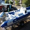
New boat is here, very happy!
Simon
www.luec.org
|